Cadmap Limited increase their surveying capacity to a 22 strong team
Cadmap employ more surveying professionals to jump on live projects throughout the UK.
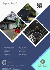
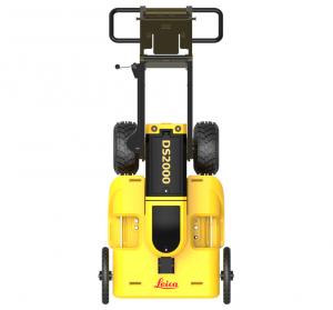
LONDON, UNITED KINGDOM, September 8, 2023/EINPresswire.com/ -- Cadmap Limited increase their surveying capacity to a 22 strong team to work on large industrial sites throughout the UK. The team are mapping out buried utilites and topographical surveys for large development schemes. Cadmap are using laser scanners and GPR surveying equipment. https://www.cadmap.co.uk/This increase in surveying capacity comes as a result of an increase in demand for these services from both the public and private sector. The team will be based in the Surrey but will be working on projects all over the UK.
Cadmap managing director, Andy Finn, said: “We are delighted to be able to increase our surveying capacity and offer our services to even more clients. We have a great team of surveyors who are all highly skilled and experienced, and we are confident that we can provide a top quality service to all of our clients.”
The team at Cadmap have a wealth of experience in surveying and mapping, and have worked on a variety of projects, both large and small. They use the latest technology and equipment to ensure that they can provide accurate and up-to-date information to their clients.
https://www.cadmap.co.uk/Surveying/LandTopographicalSurveys
Why do clients ask for a topographical survey to be overlaid on a buried services utility survey?
Cadmap's senior utilities surveyor, Adam Page answered, 'Conflict Detection and Avoidance: Overlaying utility information on top of topographical data helps identify potential conflicts and challenges early in the planning and design stages. For example, if an underground utility intersects with a planned building foundation or road alignment, this can be detected and addressed before construction begins. Avoiding such conflicts saves time, reduces project delays, and minimizes costly rework.' https://www.cadmap.co.uk/Surveying/PAS128UTILITYSURVEYS
'In summary, overlaying a utility survey on a topographical survey is a best practice in many engineering and construction projects because it enhances project planning, design, safety, and efficiency. It allows project stakeholders to make informed decisions, avoid conflicts, and optimize the use of the land while safeguarding underground utilities and complying with regulatory requirements.'
If you require any surveying or mapping services, then please do not hesitate to get in touch with Cadmap Limited. We would be more than happy to discuss your requirements and provide you with a free quote. https://www.cadmap.co.uk/
MIke Brett
Cadmap Ltd
email us here
Visit us on social media:
Facebook
Twitter
LinkedIn
Instagram
YouTube
Legal Disclaimer:
EIN Presswire provides this news content "as is" without warranty of any kind. We do not accept any responsibility or liability for the accuracy, content, images, videos, licenses, completeness, legality, or reliability of the information contained in this article. If you have any complaints or copyright issues related to this article, kindly contact the author above.


