IMPORTANT - EIN Presswire is proud to announce the launch of its AI-powered press release generator. Try it now!

There were 1,216 press releases posted in the last 24 hours and 400,913 in the last 365 days.

Geoscience Australia Press Releases

77 Press Releases
  • Published on January 24, 2023 - 22:59 GMT

    Voyage of discovery to the East Antarctic margin

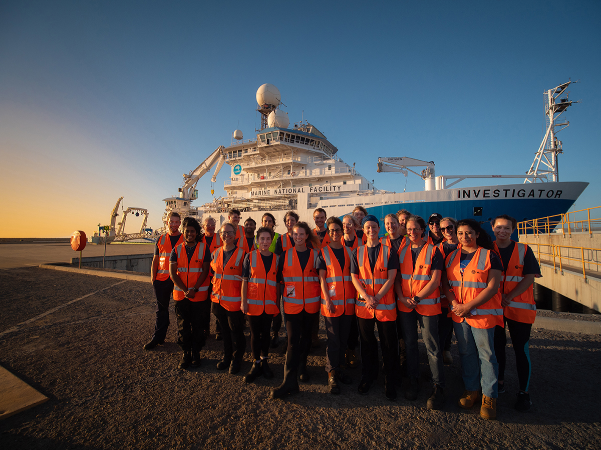
    CSIRO research vessel (RV) Investigator and the team that are on their way to the East Antarctic margin A Geoscience Australia-led scientific voyage has departed Perth this week for East Antarctica aboard CSIRO research vessel (RV) Investigator. During …

    Distribution channels:
  • Published on January 11, 2023 - 23:00 GMT

    Revealing the hidden resource potential of Tasmania

    New data will put the spotlight on the hidden geology beneath the feet of Tasmanians, as part of the Australian Government’s Exploring for the Future program. Last year, a helicopter carrying radiometric and magnetic surveying equipment flew across nearly …

    Distribution channels:
  • Published on December 22, 2022 - 06:21 GMT

    Advancing our understanding of the Great Artesian Basin

    The Great Artesian Basin (GAB) is Australia's most significant hydrogeological system. Covering more than 1.7 million square kilometres, it is Australia’s largest groundwater basin, underlying parts of Queensland, New South Wales, South Australia and …

    Distribution channels:
  • Published on September 27, 2022 - 00:01 GMT

    SouthPAN early Open Services are live

    Industry can now access the benefits of accurate and reliable positioning services from the Southern Positioning Augmentation Network (SouthPAN), with early Open Services live as of 26 September 2022. This comes just two weeks after Geoscience Australia …

    Distribution channels:
  • Published on April 14, 2021 - 03:41 GMT

    Satellite imagery reveals three decades of coastal change

    The evolution of Australia’s coastlines can now be seen in unprecedented scale and detail, via a new tool developed by Geoscience Australia’s Digital Earth Australia (DEA) program. Using satellite imagery collected since 1988, DEA Coastlines maps annual …

    Distribution channels:
  • Published on November 30, 2020 - 23:35 GMT

    Preparing for the unexpected — Knowing when, where, and the impact of tropical cyclones

    With the return of La Niña to Australia, it’s more important than ever for emergency managers and communities to be better prepared for severe weather. The 2020 Tropical Cyclone Outlook, recently issued by the Bureau of Meteorology, indicates that as we …

    Distribution channels:
  • Published on October 6, 2020 - 22:23 GMT

    Gravity: More than meets the eye

    Ever opted to take the stairs over the lift for the sake of additional exercise? You’ll be pleased to know that on reaching the top, you’ll appear to weigh an average 100 mg less than what you did at the bottom! Think that’s impressive? Try 2.4 grams less …

    Distribution channels:
  • Published on May 21, 2020 - 22:00 GMT

    How the world’s largest earthquake made waves in Australia

    Tsunami in Australia are rare, yet when they do occur, they pose a serious risk to our large coastal population. Looking at past events helps us understand how tsunami might impact Australia in the future. The 1960 Chile earthquake and subsequent tsunami …

    Distribution channels:
  • Published on December 20, 2019 - 02:12 GMT

    The beauty of Earth observations – art that informs our modern world

    We have been observing the Earth and its processes for centuries to understand the world around us and how it’s changing. Since the launch of satellites into space, they have improved our ability to monitor the Earth at a large scale. Geoscience Australia …

    Distribution channels:
  • Published on November 4, 2019 - 00:30 GMT

    40 years of Landsat in Australia

    The Alice Springs Satellite Ground Station Geoscience Australia’s Alice Springs satellite ground station hosts two 9 metre antennas, a 2.4-metre antenna, and associated infrastructure. The satellite ground station is one of three forming a global Landsat …

    Distribution channels:
  • Published on October 21, 2019 - 22:56 GMT

    Geoscience Australia’s role in space weather monitoring

    Andrew Lewis—Geomagnetism Lead Scientist, shares his insights on the potential threat of space weather, and how Geoscience Australia’s network of geomagnetic observatories play their part protecting communities and infrastructure. Imagine if all the …

    Distribution channels:
  • Published on August 13, 2019 - 03:56 GMT

    30 years on – Commemorating the 1989 Newcastle Earthquake

    The 1989 Newcastle earthquake At 10.27am on Thursday, 28 December 1989, Newcastle was devastated by an ML 5.6 (MW 5.4) earthquake. This was one of the most significant natural disasters in Australia's history. The epicentre was approximately 15 km SW …

    Distribution channels:
  • Published on June 28, 2018 - 00:15 GMT

    MH370 - Data Release

    The search for MH370 involved the collection and analysis of large volumes of marine data from a remote area. The data obtained during the Phase One and Two of sea floor mapping is now available to the public. Fly-over video of the whole of the MH370 …

    Distribution channels:
  • Published on April 26, 2016 - 02:08 GMT

    Water Observations from Space contribute to a greater understanding of flooding in Australia

    Norman Mueller Geoscience Australia contributes to a greater understanding of natural hazard and disaster exposure through observations of water from space. This supports Australia's capability to reduce the economic, social and environmental impacts …

    Distribution channels:
  • Published on April 13, 2016 - 00:08 GMT

    Your position has never been more important

    This article was published to coincide with the Locate 16 Conference, the national conference of the spatial and surveying industries of Australia and New Zealand. Australia faces critical challenges to our economy and our lifestyle - finding and …

    Distribution channels:
  • Published on December 22, 2015 - 03:56 GMT

    Navigating Australia's largest groundwater resource

    The most comprehensive mapping report on Australia's largest groundwater basin has been developed in the form of an Atlas - providing valuable information to assist water managers and communities to make more informed decisions towards sustainable …

    Distribution channels:
  • Published on December 16, 2014 - 00:43 GMT

    Ten years on: 2004 Indian Ocean tsunami

    Australia's world-class tsunami warning system now operates 24 hours a day and is a major component of a multinational Indian Ocean tsunami warning system. At the time of the 2004 Indian Ocean Tsunami, Australia relied on the existing Australian …

    Distribution channels: