
SPREP GIS training programme build Fiji’s capacity for natural resource management and conservation
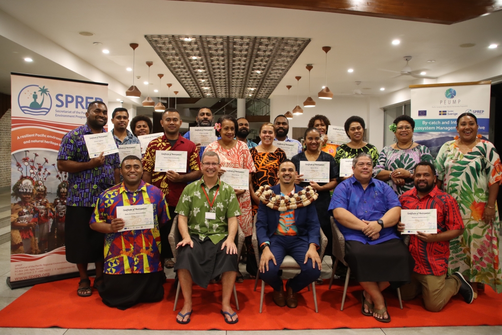
26 August 2024 - An intensive five-day training programme on “Empowering Natural Resource Management and Conservation through Spatial Technologies” concluded on 24th August at the Pearl Resort in Pacific Harbour in Fiji with participants expressing confidence in applying their new-found skills and in strengthening inter-agency working relations.
In closing the training, Dr Sivendra Michael, Permanent Secretary, Ministry of Environment and Climate Change (MECC) highlighted the power of Geographic Information Systems (GIS) mapping technology in enhancing natural resource management and conservation efforts.
“Today, we stand at a critical juncture in Fiji's environmental stewardship. Climate change, habitat loss, and increasing demands on our ecosystems require us to adopt innovative and effective approaches to environmental management. Through harnessing the potential of spatial technologies, we can revolutionise how we understand, monitor, and protect our natural heritage. GIS allows us to map, analyse and visualise complex environmental data and provides crucial insights for informed decision-making.”
The Permanent Secretary urged participants to use the knowledge they have acquired towards making meaningful decisions for Fiji's ongoing conservation efforts.
Kasaqa Tora, SPREP’s Spatial Analysis Specialist – Protected Areas and workshop co-facilitator, said “There is a growing recognition of the importance of GIS in informed decision-making processes and this introductory GIS training programme was tailored to enhance the capacity of stakeholders in Fiji to utilise GIS tools and techniques effectively within the framework of the SPREP By-catch and Integrated Ecosystems Management (BIEM) Initiative being implemented in Fiji.”
“Key government departments lack some form of GIS capacity and by investing in GIS training and having access to the right resources, organisations and governments can build capacity within their workforce to address complex environmental challenges, promote sustainable development, and safeguard natural resources for future generations,” said Vani Koroisamanunu, SPREP’s Environmental GIS Specialist and co-facilitator for the workshop.
The training participants were from iTaukei Land & Fisheries Commission, Ministry of iTaukei Affairs, iTaukei Affairs Board, Namosi Provincial Council, Ministry of Tourism and Civil Aviation, Ministry of Agriculture and Waterways, Serua Provincial Council, Rewa Provincial Council, Ministry of Environment and Climate Change - Department of Environment. All these government ministries and agencies rely on availability and understanding of data for planning and policy to inform decision-making.
“Our participants had varying skills and knowledge with some who use GIS daily in their work and others who are yet to do so,” explained Anish Maharaj, the BIEM in-country coordinator with MECC.
“The first step in the programme involved getting those who were new to GIS comfortable with the technology basics. We focused on encouraging group learning and hands on work right from the start, and this set the scene for highly interactive and positive sessions.”
“I came with very basic knowledge of GIS but after this training I feel very confident in my understanding of this tool, especially its value in my work with communities and identifying conservation sites,” said Menani Rainima, Namosi Provincial Conservation Officer. “Mapping helps to turn complex data into something everyone can understand. When I am working with communities, just one map can help me explain many things.”
Participants used Q-GIS open sourcing mapping software and Maps Me mobile applications to practice collecting sample points and mapping a part of the Navua-Galoa landscape and coastline and to process the data. The resulting maps provided a snapshot of these areas and possible threats and risks.
Sarwan Kumar, Senior Environment Officer from the Northern Division said, “I have used GIS only for monitoring purposes in my work, but this workshop has shown me what the software can do in terms of collecting, analysing and interpreting data and using it to understand patterns in an area.”
The Fiji workshop is one of a series of capacity building activities led by SPREP to enable its Pacific island Members to fulfil their commitments to multilateral environment agreements, including through the use of spatial technology for developing evidence-based rationale for strengthening natural resource management and conservation.
The training embodies the spirit of collaboration and a sustained commitment to environmental conservation efforts. The workshop was facilitated by the Secretariat of the Pacific Regional Environment Programme (SPREP) as a partnership between three SPREP programmes funded by the European Union (EU) and implemented regionally and in Fiji: the By-catch and Integrated Ecosystem Management (BIEM) Initiative; the African Caribbean Pacific Multilateral Environmental Agreements (ACP/MEAs) Programme Phase 3; and the Biodiversity and Protected Areas Management (BIOPAMA3) Project. The BIEM Initiative is a component of the Pacific-European Union Marine Partnership (PEUMP) Programme funded by the European Union and the Government of Sweden. An objective of the BIEM Initiative in Fiji is to build capacity through field and local level training for assessing and mapping information towards integrated ecosystem management.
To find out more about the BIEM Initiative, please contact Mr Kenneth Kassem at [email protected]
For the BIOPAMA3 project, please contact Mrs Kasaqa Tora at [email protected]
For the ACP/MEA3 project, please contact Mrs Vani Koroisamanunu at [email protected]
Legal Disclaimer:
EIN Presswire provides this news content "as is" without warranty of any kind. We do not accept any responsibility or liability for the accuracy, content, images, videos, licenses, completeness, legality, or reliability of the information contained in this article. If you have any complaints or copyright issues related to this article, kindly contact the author above.
