Chula Vista PD taps AirData to Provide Community Transparency
Chula Vista Police Department’s Drone As a First Responder Program is powered by AirData UAV.
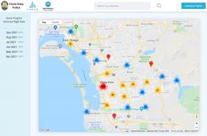
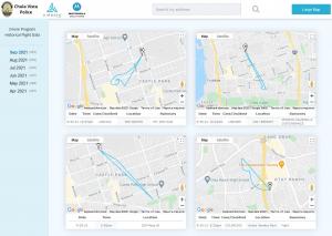
EL DORADO HILLS, CALIFORNIA, UNITED STATES, October 5, 2021 /EINPresswire.com/ -- Chula Vista Police Department (CVPD), with its nationally recognized drone program selected AirData UAV to assist in providing drone flight transparency to the public. AirData now offers Chula Vista residents the ability to view and understand the exact location, flight path, and purpose behind each police drone deployment.
“Transparency and accountability are key components in the success of our drone program which has been an invaluable tool in maintaining the safety of our officers and the public. We pride ourselves on ensuring the public has access to our drone flight information in upholding the trust of our community.” - Chief Roxana Kennedy, Chula Vista Police Department
CVPD has been an innovator in the industry bringing its drone program to light in October of 2018. Since then, the program has continued to expand its capabilities and now provides additional transparency to constituents through the partnership with AirData. The CVPD Drone Program Historical Flight Data page is available here: https://app.airdata.com/u/cvpd
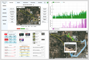
AirData provides CVPD with a seamless and simple way to track and manage all of the flight data from their missions. Officers can focus on what’s important - keeping the community safe with drone technology, letting the integration provide effortless data collection and automatic reporting. Federal compliance, reporting, maintenance notifications, and logging are time-intensive tasks, and AirData manages these tasks in the background, enabling police departments to focus on keeping the community safe.
“We are excited to work closely with Chula Vista to provide full transparency of the police department flights to the community,” said Eran Steiner, Founder and CEO of AirData UAV. “AirData enables officers to focus on the community, while AirData performs the mundane and time-consuming work of flight data collection, federal compliance tracking, and crash prevention through tracking drone health. Chula Vista offers its residents an open AirData-driven web page, enabling the public to be well informed of drone-related law enforcement activity.”
AirData UAV is an industry leader in drone fleet management and offers a robust integration for departments looking to benefit from a comprehensive Drone as First Responder (DFR) program. Communities immensely benefit when using DFR callouts by saving lives, reducing response times, and saving tax dollars while increasing citizen and officer safety.
-----------------------------------------------------------------------------------------------------------------------
About Chula Vista Police Department
The mission of the Chula Vista Police Department’s UAS Program is to provide airborne support to police operations in a safe, responsible, and transparent manner to preserve the peace, reduce response times and increase the quality of life in Chula Vista.
To learn more about CVPD’s Drone Program click this link: https://www.chulavistaca.gov/departments/police-department/programs/uas-drone-program
About AirData UAV
AirData is the largest online drone fleet data management and real-time flight streaming platform, serving over 210,000 users with 20 million flights uploaded to date, processing an average of 20,000 flights a day, with high-resolution data stored per each flight. It is used by large fleet operators around the world not only as a logbook, but also as a comprehensive flight safety data analysis and crash prevention platform, with advanced maintenance, pilot tracking, and easy-to-use live streaming.
To learn more: https://AirData.com/
Kathryn Nichols
AirData
+1 530-558-5429
kathryn@airdata.com
Visit us on social media:
Facebook
Twitter
LinkedIn
Legal Disclaimer:
EIN Presswire provides this news content "as is" without warranty of any kind. We do not accept any responsibility or liability for the accuracy, content, images, videos, licenses, completeness, legality, or reliability of the information contained in this article. If you have any complaints or copyright issues related to this article, kindly contact the author above.


